


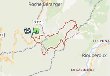
Chamrousse - Autour de l'Arselle

maupassant38
User

Length
8.1 km

Max alt
1735 m

Uphill gradient
239 m
Km-Effort
11.3 km

Min alt
1608 m

Downhill gradient
237 m
Boucle
Yes
Creation date :
2020-09-05 08:28:50.301
Updated on :
2020-09-05 13:24:56.932
2h00
Difficulty : Easy

FREE GPS app for hiking
 SityTrail
IGN / Geographical institutes
SityTrail Plus
The world is yours!
About
Trail Walking of 8.1 km to be discovered at Auvergne-Rhône-Alpes, Isère, Vaulnaveys-le-Haut. This trail is proposed by maupassant38.
Positioning
Country:
France
Region :
Auvergne-Rhône-Alpes
Department/Province :
Isère
Municipality :
Vaulnaveys-le-Haut
Location:
Unknown
Start:(Dec)
Start:(UTM)
725687 ; 4997996 (31T) N.
Comments