


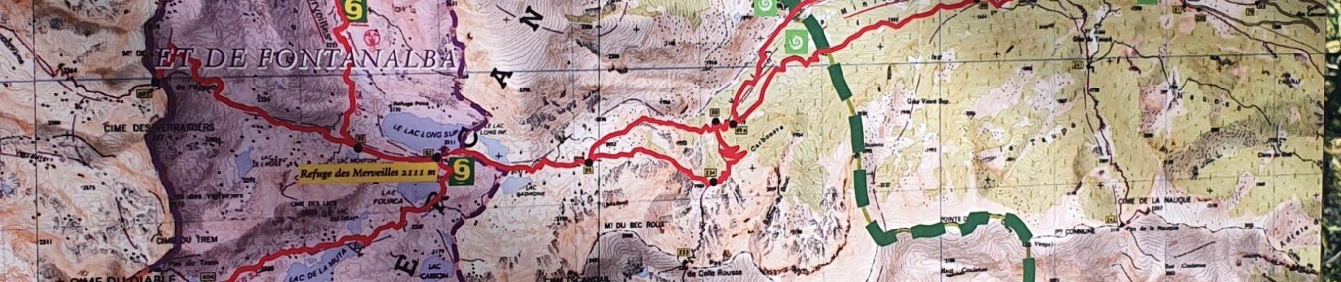
casterino vallon de fontanable

marchev
User
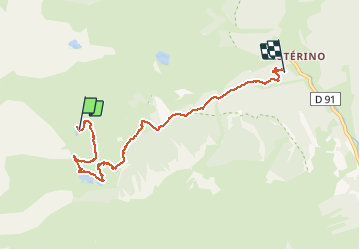

Length
6.4 km

Max alt
2243 m

Uphill gradient
46 m
Km-Effort
9.1 km

Min alt
1609 m

Downhill gradient
670 m
Boucle
No
Creation date :
2020-09-05 11:38:13.688
Updated on :
2020-09-06 04:20:44.658
2h55
Difficulty : Medium

FREE GPS app for hiking
 SityTrail
IGN / Geographical institutes
SityTrail Plus
The world is yours!
About
Trail Walking of 6.4 km to be discovered at Provence-Alpes-Côte d'Azur, Maritime Alps, Tende. This trail is proposed by marchev.
Photos


Positioning
Country:
France
Region :
Provence-Alpes-Côte d'Azur
Department/Province :
Maritime Alps
Municipality :
Tende
Location:
Unknown
Start:(Dec)
Start:(UTM)
377470 ; 4882946 (32T) N.
Comments