


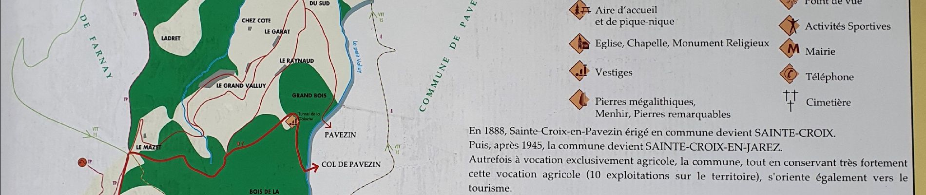
Saint Croix en Jarrez

Sigmut
User
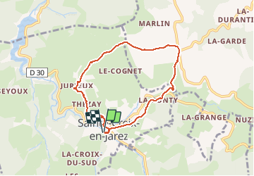

Length
7.1 km

Max alt
588 m

Uphill gradient
204 m
Km-Effort
9.8 km

Min alt
417 m

Downhill gradient
202 m
Boucle
Yes
Creation date :
2020-09-06 10:59:20.085
Updated on :
2020-09-06 14:29:32.194
2h08
Difficulty : Easy

FREE GPS app for hiking
 SityTrail
IGN / Geographical institutes
SityTrail Plus
The world is yours!
About
Trail Walking of 7.1 km to be discovered at Auvergne-Rhône-Alpes, Loire, Sainte-Croix-en-Jarez. This trail is proposed by Sigmut.
Photos


Positioning
Country:
France
Region :
Auvergne-Rhône-Alpes
Department/Province :
Loire
Municipality :
Sainte-Croix-en-Jarez
Location:
Unknown
Start:(Dec)
Start:(UTM)
628625 ; 5037445 (31T) N.
Comments