Trail On foot Marseille - 
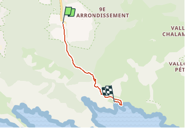
la calanque de Sugiton - Photo
 gdela
gdela

User

© OpenStreetMap contributors
Length
Length
3.7 km
Max alt
Max alt
219 m
Uphill gradient
Uphill gradient
106 m
Km-Effort
Km-Effort  
5.4 km
Min alt
Min alt
5 m
Downhill gradient
Downhill gradient
206 m
Boucle
Boucle
No
Creation date :
2020-09-08 21:15:06.348
Updated on :
2020-09-10 13:45:07.11

(0 Reviews)

On foot
On foot
--
Difficulty : Medium

Scan this QR Code to open this trail in the SityTrail application

FREE GPS app for hiking

Logo SityTrail SityTrail

IGN / Geographical institutes

Download SityTrail from the App Store Download SityTrail from Google Play

Logo SityTrail SityTrail Plus

The world is yours!

Download SityTrail from the App Store Download SityTrail from Google Play Download SityTrail on Huawei AppGallery

About

Trail On foot of 3.7 km to be discovered at Provence-Alpes-Côte d'Azur, Bouches-du-Rhône, Marseille. This trail is proposed by gdela.

Description

- PR4 - 3H30 (Topo-Guides les calanques à pied)
Luminy 10 km au sud-est de Marseille.
transport : terminus du bus 21
balisage :  jaune pointillé, blanc-rouge, rouge pointillé, rouge,
le retour par le même tracé qu'à l'aller soit 7 km

Elevation profile

Positioning

Country:
France
Region :
Provence-Alpes-Côte d'Azur
Department/Province :
Bouches-du-Rhône
Municipality :
Marseille
Location:
9th Arrondissement
Start:(UTM)
697874 ; 4789402 (31T) N.


Close
My subscriptions