


rutali tra aghje e pagliaghji

gnortier
User
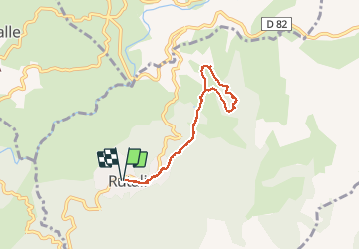

Length
6.5 km

Max alt
615 m

Uphill gradient
128 m
Km-Effort
8.2 km

Min alt
547 m

Downhill gradient
129 m
Boucle
Yes
Creation date :
2020-09-11 13:41:36.386
Updated on :
2020-09-11 15:56:24.009
2h14
Difficulty : Easy

FREE GPS app for hiking
 SityTrail
IGN / Geographical institutes
SityTrail Plus
The world is yours!
About
Trail Walking of 6.5 km to be discovered at Corsica, Haute-Corse, Rutali. This trail is proposed by gnortier.
Positioning
Country:
France
Region :
Corsica
Department/Province :
Haute-Corse
Municipality :
Rutali
Location:
Unknown
Start:(Dec)
Start:(UTM)
529728 ; 4714215 (32T) N.
Comments
Rutali