


plage tamarone

gnortier
User
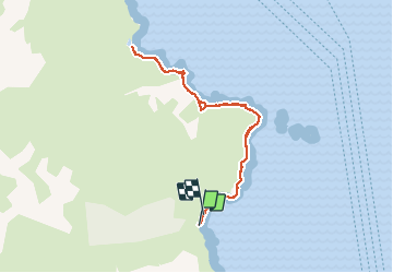

Length
8.2 km

Max alt
45 m

Uphill gradient
179 m
Km-Effort
10.6 km

Min alt
-6 m

Downhill gradient
180 m
Boucle
Yes
Creation date :
2020-09-12 11:04:17.286
Updated on :
2020-09-12 13:58:31.746
2h53
Difficulty : Easy

FREE GPS app for hiking
 SityTrail
IGN / Geographical institutes
SityTrail Plus
The world is yours!
About
Trail Walking of 8.2 km to be discovered at Corsica, Haute-Corse, Rogliano. This trail is proposed by gnortier.
Positioning
Country:
France
Region :
Corsica
Department/Province :
Haute-Corse
Municipality :
Rogliano
Location:
Unknown
Start:(Dec)
Start:(UTM)
536970 ; 4757980 (32T) N.
Comments