Trail Walking Daluis - Mont Saint Honorat - Photo
 aris
aris

User

© OpenStreetMap contributors
Length
Length
12.2 km
Max alt
Max alt
2497 m
Uphill gradient
Uphill gradient
1047 m
Km-Effort
Km-Effort  
26 km
Min alt
Min alt
1457 m
Downhill gradient
Downhill gradient
1049 m
Boucle
Boucle
Yes
Creation date :
2020-09-13 07:10:01.579
Updated on :
2020-09-13 18:56:35.751

(0 Reviews)

Walking
Walking
5h48
Difficulty : Medium

Scan this QR Code to open this trail in the SityTrail application

FREE GPS app for hiking

Logo SityTrail SityTrail

IGN / Geographical institutes

Download SityTrail from the App Store Download SityTrail from Google Play

Logo SityTrail SityTrail Plus

The world is yours!

Download SityTrail from the App Store Download SityTrail from Google Play Download SityTrail on Huawei AppGallery

About

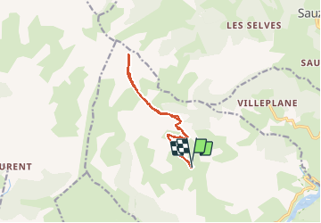
Trail Walking of 12.2 km to be discovered at Provence-Alpes-Côte d'Azur, Maritime Alps, Daluis. This trail is proposed by aris.

Description

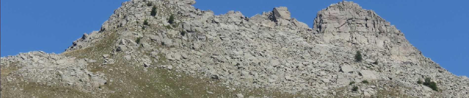
Au départ de la Pinée (Daluis). Sans difficulté jusqu'à la base du sommet (environ 2400m). La suite du parcours se fait en grimpant sur des blocs plus ou moins stables. L'ascension se termine par un gros monticule de cailloux (une sorte de gros cairn de 20m de haut) un peu scabreux et aérien.
Belles vues sur toutes alpes du Sud, mais le temps trop brumeux et les nuages lointains nous ont empêchés de voir la Corse, le Mt Viso et la Barre des Ecrins.

Elevation profile

Photos

Positioning

Country:
France
Region :
Provence-Alpes-Côte d'Azur
Department/Province :
Maritime Alps
Municipality :
Daluis
Location:
Unknown
Start:(UTM)
322792 ; 4879230 (32T) N.


Close
My subscriptions