


gravures pas de l arpette

baygonvert
User
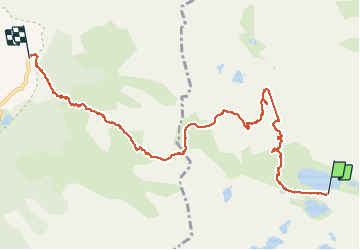

Length
9.9 km

Max alt
2514 m

Uphill gradient
441 m
Km-Effort
17.3 km

Min alt
1685 m

Downhill gradient
886 m
Boucle
No
Creation date :
2020-09-13 06:35:43.662
Updated on :
2020-09-13 14:42:02.058
3h27
Difficulty : Medium

FREE GPS app for hiking
 SityTrail
IGN / Geographical institutes
SityTrail Plus
The world is yours!
About
Trail Walking of 9.9 km to be discovered at Provence-Alpes-Côte d'Azur, Maritime Alps, Tende. This trail is proposed by baygonvert.
Positioning
Country:
France
Region :
Provence-Alpes-Côte d'Azur
Department/Province :
Maritime Alps
Municipality :
Tende
Location:
Unknown
Start:(Dec)
Start:(UTM)
375953 ; 4879374 (32T) N.
Comments