


wassebourg col

lemuid
User
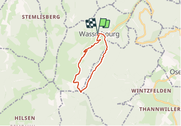

Length
9.1 km

Max alt
901 m

Uphill gradient
389 m
Km-Effort
14.3 km

Min alt
507 m

Downhill gradient
393 m
Boucle
Yes
Creation date :
2020-09-14 08:04:59.229
Updated on :
2020-09-19 20:00:47.994
2h10
Difficulty : Easy

FREE GPS app for hiking
 SityTrail
IGN / Geographical institutes
SityTrail Plus
The world is yours!
About
Trail Walking of 9.1 km to be discovered at Grand Est, Haut-Rhin, Wasserbourg. This trail is proposed by lemuid.
Positioning
Country:
France
Region :
Grand Est
Department/Province :
Haut-Rhin
Municipality :
Wasserbourg
Location:
Unknown
Start:(Dec)
Start:(UTM)
362696 ; 5318234 (32U) N.
Comments