Trail Walking Valdieri - Refuge Questa- Préfouns-Salèse - Photo

Refuge Questa- Préfouns-Salèse

 ch2slv
ch2slv

User

© OpenStreetMap contributors
Length
Length
12.9 km
Max alt
Max alt
2628 m
Uphill gradient
Uphill gradient
426 m
Km-Effort
Km-Effort  
21 km
Min alt
Min alt
1675 m
Downhill gradient
Downhill gradient
1106 m
Boucle
Boucle
No
Creation date :
2020-09-15 06:09:10.819
Updated on :
2020-09-15 19:36:58.606

(0 Reviews)

Walking
Walking
4h26
Difficulty : Difficult

Scan this QR Code to open this trail in the SityTrail application

FREE GPS app for hiking

Logo SityTrail SityTrail

IGN / Geographical institutes

Download SityTrail from the App Store Download SityTrail from Google Play

Logo SityTrail SityTrail Plus

The world is yours!

Download SityTrail from the App Store Download SityTrail from Google Play Download SityTrail on Huawei AppGallery

About

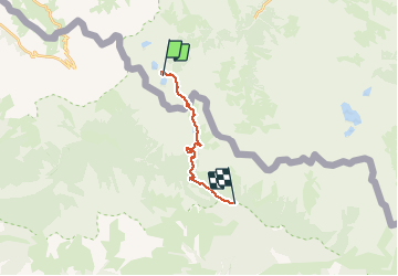
Trail Walking of 12.9 km to be discovered at Piemont, Cuneo, Valdieri. This trail is proposed by ch2slv.

Description

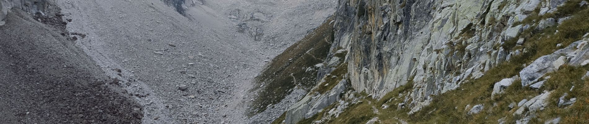
Depuis le refuge en passant par le pas du Préfouns, le lac Nègre jusqu'au parking de Salèse. La montée en Italie du Préfouns est très minérale et encaissée mais toujours très bien tracée. la fin est très pentue et sableuse. le contraste avec la partie française est saisissant. Longue longue descente.

Elevation profile

Photos

Positioning

Country:
Italy
Region :
Piemont
Department/Province :
Cuneo
Municipality :
Valdieri
Location:
Unknown
Start:(UTM)
357409 ; 4893792 (32T) N.


Close
My subscriptions