Précherel-Cx Allant

Bogapuki
User
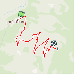

Length
3.9 km

Max alt
1569 m

Uphill gradient
571 m
Km-Effort
9.6 km

Min alt
987 m

Downhill gradient
0 m
Boucle
No
Creation date :
2018-11-25 09:19:34.769
Updated on :
2018-11-25 09:19:34.769
2h18
Difficulty : Easy

FREE GPS app for hiking
 SityTrail
IGN / Geographical institutes
SityTrail Plus
The world is yours!
About
Trail Walking of 3.9 km to be discovered at Auvergne-Rhône-Alpes, Savoy, Jarsy. This trail is proposed by Bogapuki.
Positioning
Country:
France
Region :
Auvergne-Rhône-Alpes
Department/Province :
Savoy
Municipality :
Jarsy
Location:
Unknown
Start:(Dec)
Start:(UTM)
281198 ; 5060624 (32T) N.
Comments