


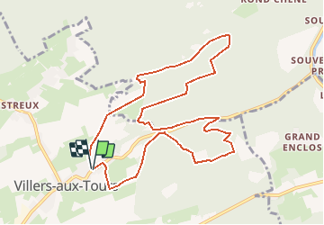
Villers aux Tours

AnneCecile
User

Length
10.2 km

Max alt
290 m

Uphill gradient
287 m
Km-Effort
14 km

Min alt
186 m

Downhill gradient
290 m
Boucle
Yes
Creation date :
2020-09-19 17:38:06.323
Updated on :
2020-09-19 17:45:37.971
3h49
Difficulty : Difficult

FREE GPS app for hiking
 SityTrail
IGN / Geographical institutes
SityTrail Plus
The world is yours!
About
Trail Walking of 10.2 km to be discovered at Wallonia, Liège, Anthisnes. This trail is proposed by AnneCecile.
Description
Départ croisement Rue Fecher et rue du village
Positioning
Country:
Belgium
Region :
Wallonia
Department/Province :
Liège
Municipality :
Anthisnes
Location:
Villers-aux-Tours
Start:(Dec)
Start:(UTM)
678538 ; 5597128 (31U) N.
Comments