


Les étangs de Bel Val 51

flzanichelli
User
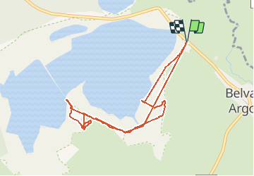

Length
4.3 km

Max alt
159 m

Uphill gradient
21 m
Km-Effort
4.6 km

Min alt
152 m

Downhill gradient
19 m
Boucle
Yes
Creation date :
2020-09-09 10:46:08.006
Updated on :
2020-09-21 06:42:51.122
3h05
Difficulty : Very easy

FREE GPS app for hiking
 SityTrail
IGN / Geographical institutes
SityTrail Plus
The world is yours!
About
Trail Walking of 4.3 km to be discovered at Grand Est, Marne, Belval-en-Argonne. This trail is proposed by flzanichelli.
Description
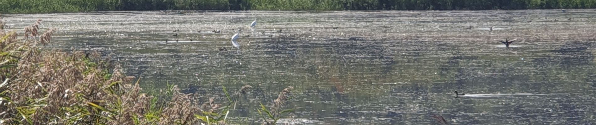
une petite ballade d'observation des oiseaux. Mais la digue est fermée et empêche de réaliser le tour du grand étang.
Photos


Positioning
Country:
France
Region :
Grand Est
Department/Province :
Marne
Municipality :
Belval-en-Argonne
Location:
Unknown
Start:(Dec)
Start:(UTM)
646142 ; 5424226 (31U) N.
Comments