


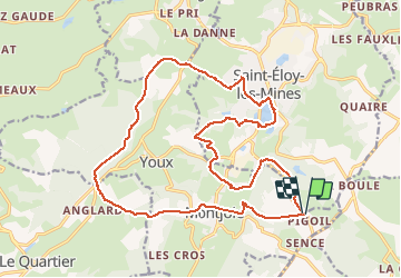
Saint Eloy les mines Pigoil - Saint Eloy

jeanic63
User

Length
22 km

Max alt
743 m

Uphill gradient
602 m
Km-Effort
30 km

Min alt
483 m

Downhill gradient
602 m
Boucle
Yes
Creation date :
2020-09-22 08:30:52.354
Updated on :
2020-09-22 08:36:58.908
--
Difficulty : Medium

FREE GPS app for hiking
 SityTrail
IGN / Geographical institutes
SityTrail Plus
The world is yours!
About
Trail On foot of 22 km to be discovered at Auvergne-Rhône-Alpes, Puy-de-Dôme, Saint-Éloy-les-Mines. This trail is proposed by jeanic63.
Description
depart de pigoil
Positioning
Country:
France
Region :
Auvergne-Rhône-Alpes
Department/Province :
Puy-de-Dôme
Municipality :
Saint-Éloy-les-Mines
Location:
Unknown
Start:(Dec)
Start:(UTM)
488072 ; 5108871 (31T) N.
Comments