


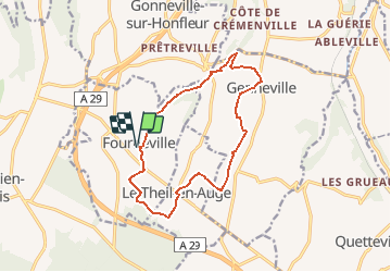
Fourneville 14. 13km

Laurent53
User

Length
12.7 km

Max alt
141 m

Uphill gradient
171 m
Km-Effort
15 km

Min alt
48 m

Downhill gradient
171 m
Boucle
Yes
Creation date :
2020-09-22 08:32:57.931
Updated on :
2020-09-22 08:35:53.868
--
Difficulty : Medium

FREE GPS app for hiking
 SityTrail
IGN / Geographical institutes
SityTrail Plus
The world is yours!
About
Trail On foot of 12.7 km to be discovered at Normandy, Calvados, Fourneville. This trail is proposed by Laurent53.
Positioning
Country:
France
Region :
Normandy
Department/Province :
Calvados
Municipality :
Fourneville
Location:
Unknown
Start:(Dec)
Start:(UTM)
299247 ; 5470802 (31U) N.
Comments