


GRP Baronnies Ste Jalle Arpavon 18km

thonyc
User GUIDE
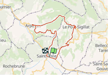

Length
18 km

Max alt
827 m

Uphill gradient
639 m
Km-Effort
27 km

Min alt
406 m

Downhill gradient
637 m
Boucle
Yes
Creation date :
2020-09-27 08:03:58.17
Updated on :
2020-10-02 13:10:00.072
5h32
Difficulty : Medium

FREE GPS app for hiking
 SityTrail
IGN / Geographical institutes
SityTrail Plus
The world is yours!
About
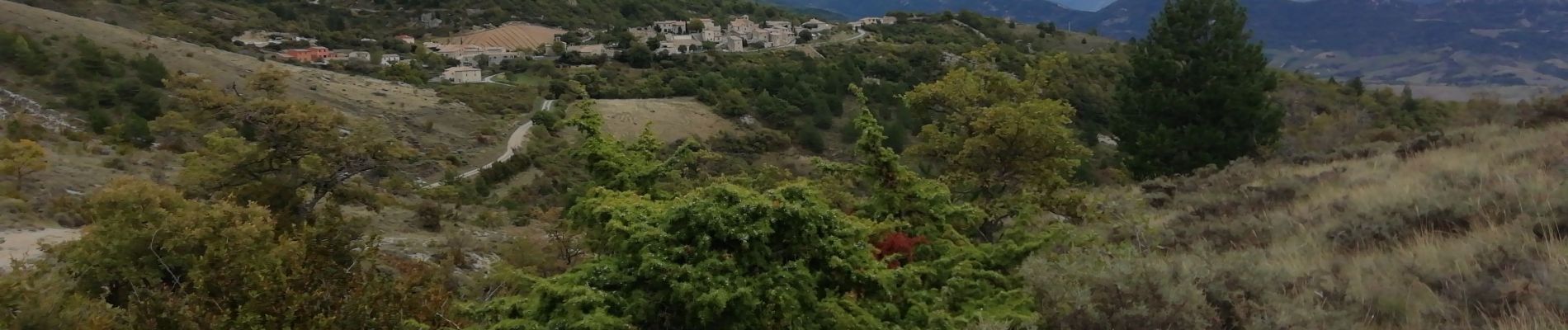
Trail Walking of 18 km to be discovered at Auvergne-Rhône-Alpes, Drôme, Sainte-Jalle. This trail is proposed by thonyc.
Photos


Positioning
Country:
France
Region :
Auvergne-Rhône-Alpes
Department/Province :
Drôme
Municipality :
Sainte-Jalle
Location:
Unknown
Start:(Dec)
Start:(UTM)
682267 ; 4912627 (31T) N.
Comments