


SityTrail - LAC DE MEAULT ?VERSION 15 KMS 340 M

LtZIP
User
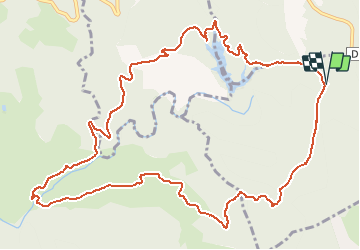

Length
14.8 km

Max alt
323 m

Uphill gradient
339 m
Km-Effort
19.3 km

Min alt
128 m

Downhill gradient
338 m
Boucle
Yes
Creation date :
2020-09-28 11:57:09.688
Updated on :
2021-02-11 06:50:20.975
4h07
Difficulty : Medium

FREE GPS app for hiking
 SityTrail
IGN / Geographical institutes
SityTrail Plus
The world is yours!
About
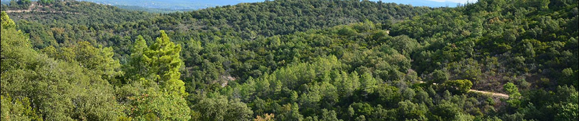
Trail Walking of 14.8 km to be discovered at Provence-Alpes-Côte d'Azur, Var, Saint-Paul-en-Forêt. This trail is proposed by LtZIP.
Description
IBP : Bleu - 48
Photos


Positioning
Country:
France
Region :
Provence-Alpes-Côte d'Azur
Department/Province :
Var
Municipality :
Saint-Paul-en-Forêt
Location:
Unknown
Start:(Dec)
Start:(UTM)
310826 ; 4826345 (32T) N.
Comments