


Cap de la Lesse

c.chehere
User
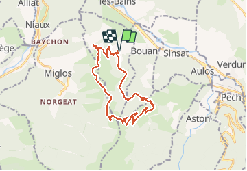

Length
15.5 km

Max alt
1492 m

Uphill gradient
599 m
Km-Effort
23 km

Min alt
905 m

Downhill gradient
603 m
Boucle
Yes
Creation date :
2020-09-29 06:57:30.281
Updated on :
2020-09-29 14:09:29.357
5h41
Difficulty : Easy

FREE GPS app for hiking
 SityTrail
IGN / Geographical institutes
SityTrail Plus
The world is yours!
About
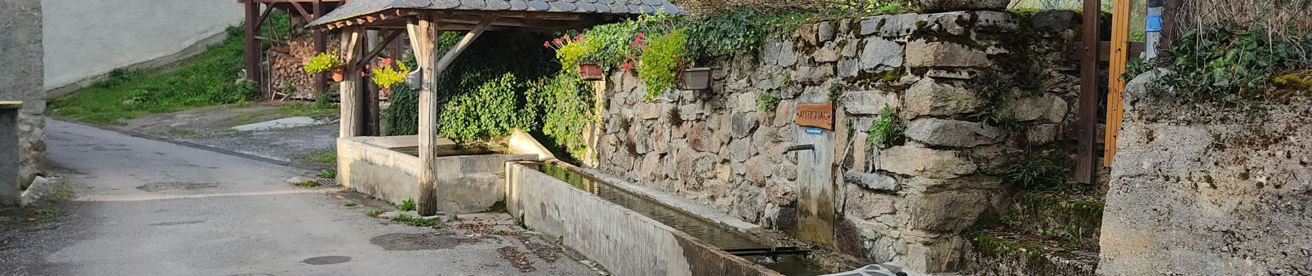
Trail Walking of 15.5 km to be discovered at Occitania, Ariège, Larnat. This trail is proposed by c.chehere.
Description
Superbe rando en crète avec vues splendides sur la vallée de l'Ariège et le Vicdessos. Les chutes de neige du WE dernier rajoutent une touche "montagne"
Photos


Positioning
Country:
France
Region :
Occitania
Department/Province :
Ariège
Municipality :
Larnat
Location:
Unknown
Start:(Dec)
Start:(UTM)
388176 ; 4739435 (31T) N.
Comments