


ROQUEFORT LES PINS

Daniel Benteux
User
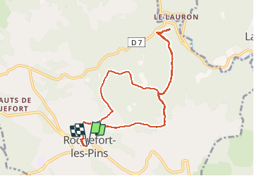

Length
11.4 km

Max alt
257 m

Uphill gradient
294 m
Km-Effort
15.3 km

Min alt
147 m

Downhill gradient
295 m
Boucle
Yes
Creation date :
2020-10-01 06:53:56.233
Updated on :
2020-10-01 12:12:12.85
5h17
Difficulty : Very easy

FREE GPS app for hiking
 SityTrail
IGN / Geographical institutes
SityTrail Plus
The world is yours!
About
Trail Walking of 11.4 km to be discovered at Provence-Alpes-Côte d'Azur, Maritime Alps, Roquefort-les-Pins. This trail is proposed by Daniel Benteux.
Description
marche
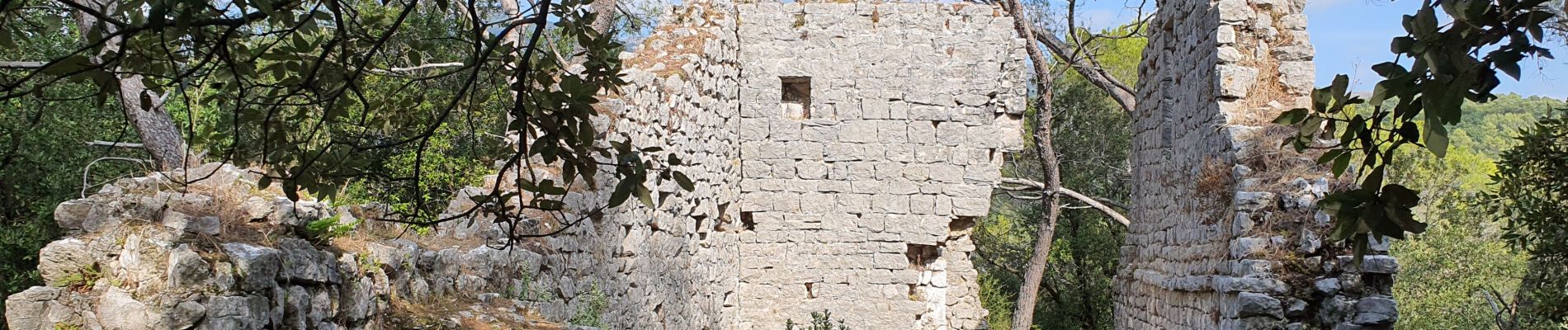
Photos


Positioning
Country:
France
Region :
Provence-Alpes-Côte d'Azur
Department/Province :
Maritime Alps
Municipality :
Roquefort-les-Pins
Location:
Unknown
Start:(Dec)
Start:(UTM)
342717 ; 4836674 (32T) N.
Comments