


Minerve - Gorges du Briant par le GR77

PiloudeBamako
User
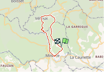

Length
12.7 km

Max alt
496 m

Uphill gradient
446 m
Km-Effort
18.7 km

Min alt
160 m

Downhill gradient
457 m
Boucle
Yes
Creation date :
2020-10-01 07:55:44.0
Updated on :
2020-10-03 14:01:04.06
3h50
Difficulty : Difficult

FREE GPS app for hiking
 SityTrail
IGN / Geographical institutes
SityTrail Plus
The world is yours!
About
Trail Walking of 12.7 km to be discovered at Occitania, Hérault, Minerve. This trail is proposed by PiloudeBamako.
Description
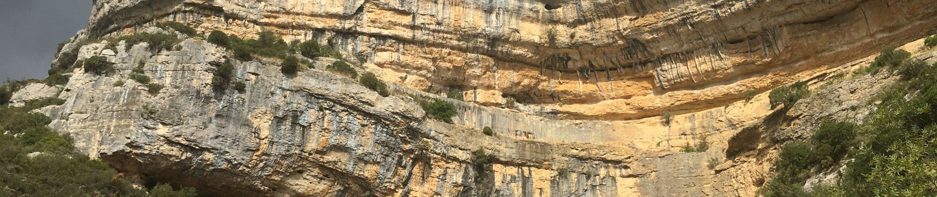
Départ de Mayranne (hameau à l'Est de Minerve). Montée vers Vélieux. Retour vers Minerve par les gorges du Briant et le GR 77.
Photos


26 photos in total. Please click on a photo to see them all in the gallery.
Positioning
Country:
France
Region :
Occitania
Department/Province :
Hérault
Municipality :
Minerve
Location:
Unknown
Start:(Dec)
Start:(UTM)
480291 ; 4800940 (31T) N.
Comments