


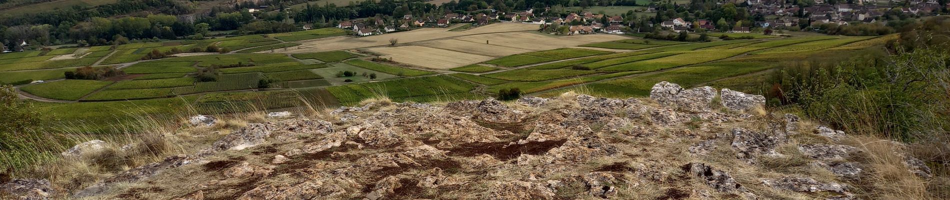
Saint Martin sous Montaigu la croix de Teu page 31

grasgilbert
User
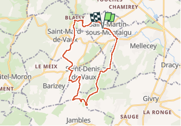

Length
15.2 km

Max alt
444 m

Uphill gradient
404 m
Km-Effort
21 km

Min alt
213 m

Downhill gradient
408 m
Boucle
Yes
Creation date :
2020-10-01 11:30:49.363
Updated on :
2022-10-05 09:23:46.08
4h16
Difficulty : Medium

FREE GPS app for hiking
 SityTrail
IGN / Geographical institutes
SityTrail Plus
The world is yours!
About
Trail Walking of 15.2 km to be discovered at Bourgogne-Franche-Comté, Saône-et-Loire, Saint-Martin-sous-Montaigu. This trail is proposed by grasgilbert.
Photos

Positioning
Country:
France
Region :
Bourgogne-Franche-Comté
Department/Province :
Saône-et-Loire
Municipality :
Saint-Martin-sous-Montaigu
Location:
Unknown
Start:(Dec)
Start:(UTM)
630470 ; 5186112 (31T) N.
Comments
bien