


cosprons la tour de la Madeloc par le refuge de la Madeloc

jeanic63
User
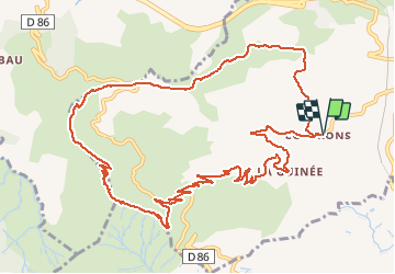

Length
15.2 km

Max alt
637 m

Uphill gradient
615 m
Km-Effort
23 km

Min alt
37 m

Downhill gradient
617 m
Boucle
Yes
Creation date :
2020-10-06 15:43:49.344
Updated on :
2020-10-06 15:47:44.126
--
Difficulty : Difficult

FREE GPS app for hiking
 SityTrail
IGN / Geographical institutes
SityTrail Plus
The world is yours!
About
Trail On foot of 15.2 km to be discovered at Occitania, Pyrénées-Orientales, Port-Vendres. This trail is proposed by jeanic63.
Description
départ hameau de Cosprons
Positioning
Country:
France
Region :
Occitania
Department/Province :
Pyrénées-Orientales
Municipality :
Port-Vendres
Location:
Unknown
Start:(Dec)
Start:(UTM)
508908 ; 4704988 (31T) N.
Comments