


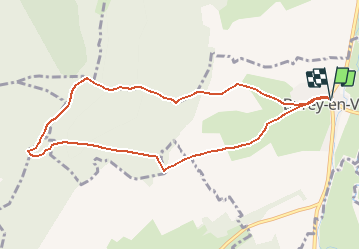
SityTrail - Burey_9km

ZAMBAUX
User

Length
8.9 km

Max alt
393 m

Uphill gradient
204 m
Km-Effort
11.6 km

Min alt
257 m

Downhill gradient
203 m
Boucle
Yes
Creation date :
2020-10-08 15:58:08.863
Updated on :
2020-10-08 16:11:43.962
2h29
Difficulty : Medium

FREE GPS app for hiking
 SityTrail
IGN / Geographical institutes
SityTrail Plus
The world is yours!
About
Trail Walking of 8.9 km to be discovered at Grand Est, Meuse, Burey-en-Vaux. This trail is proposed by ZAMBAUX.
Positioning
Country:
France
Region :
Grand Est
Department/Province :
Meuse
Municipality :
Burey-en-Vaux
Location:
Unknown
Start:(Dec)
Start:(UTM)
696897 ; 5382359 (31U) N.
Comments