


Mirwart

fra_depoorter
User
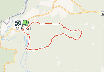

Length
7.2 km

Max alt
439 m

Uphill gradient
166 m
Km-Effort
9.4 km

Min alt
279 m

Downhill gradient
165 m
Boucle
Yes
Creation date :
2020-10-08 12:00:11.014
Updated on :
2020-10-08 19:49:02.898
1h48
Difficulty : Easy

FREE GPS app for hiking
 SityTrail
IGN / Geographical institutes
SityTrail Plus
The world is yours!
About
Trail Walking of 7.2 km to be discovered at Wallonia, Luxembourg, Saint-Hubert. This trail is proposed by fra_depoorter.
Positioning
Country:
Belgium
Region :
Wallonia
Department/Province :
Luxembourg
Municipality :
Saint-Hubert
Location:
Mirwart
Start:(Dec)
Start:(UTM)
662093 ; 5547387 (31U) N.
Comments
Heerlijke rust. amper medewandelaars op een zaterdag.