


hakrpute

Frings
User
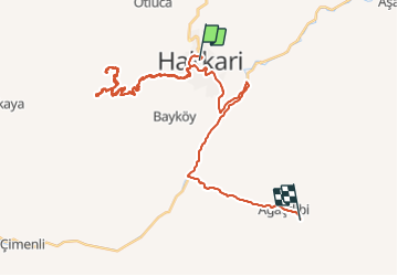

Length
46 km

Max alt
2593 m

Uphill gradient
2082 m
Km-Effort
74 km

Min alt
1199 m

Downhill gradient
2061 m
Boucle
No
Creation date :
2014-12-10 00:00:00.0
Updated on :
2014-12-10 00:00:00.0
2h25
Difficulty : Unknown

FREE GPS app for hiking
 SityTrail
IGN / Geographical institutes
SityTrail Plus
The world is yours!
About
Trail Other activity of 46 km to be discovered at Hakkâri, Hakkari merkez. This trail is proposed by Frings.
Positioning
Country:
Turkey
Region :
Hakkâri
Department/Province :
Hakkari merkez
Municipality :
Unknown
Location:
Unknown
Start:(Dec)
Start:(UTM)
388514 ; 4159560 (38S) N.
Comments