


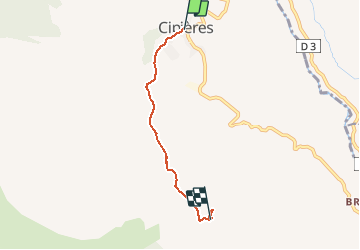
Cipières - Graus de Pons

franquen
User

Length
4 km

Max alt
991 m

Uphill gradient
264 m
Km-Effort
6.8 km

Min alt
762 m

Downhill gradient
38 m
Boucle
No
Creation date :
2020-10-12 08:37:53.397
Updated on :
2020-10-12 16:51:17.425
1h32
Difficulty : Easy

FREE GPS app for hiking
 SityTrail
IGN / Geographical institutes
SityTrail Plus
The world is yours!
About
Trail Walking of 4 km to be discovered at Provence-Alpes-Côte d'Azur, Maritime Alps, Cipières. This trail is proposed by franquen.
Positioning
Country:
France
Region :
Provence-Alpes-Côte d'Azur
Department/Province :
Maritime Alps
Municipality :
Cipières
Location:
Unknown
Start:(Dec)
Start:(UTM)
335507 ; 4849792 (32T) N.
Comments