


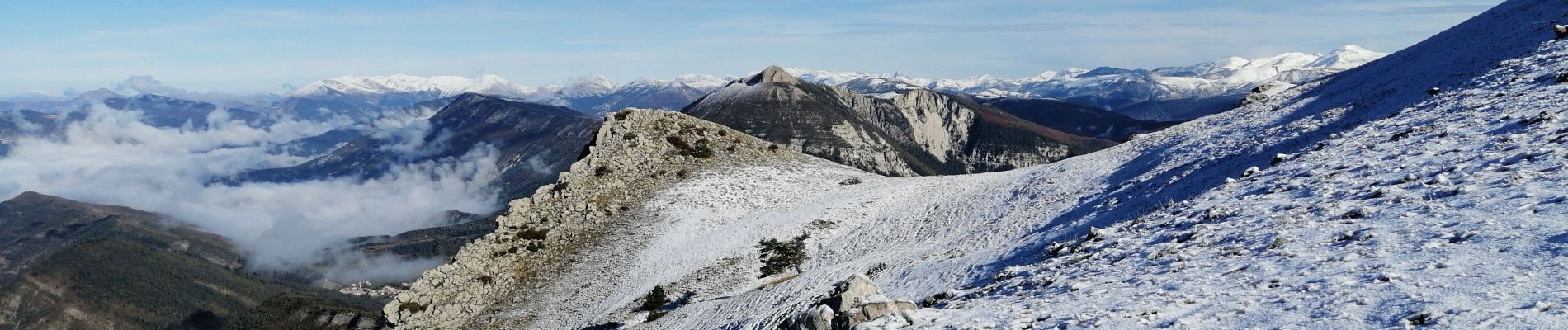
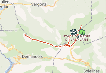
Crête de Bernarde

domi06
User

Length
15.7 km

Max alt
1926 m

Uphill gradient
707 m
Km-Effort
25 km

Min alt
1577 m

Downhill gradient
704 m
Boucle
Yes
Creation date :
2020-10-15 07:17:17.218
Updated on :
2021-02-17 16:37:47.725
6h19
Difficulty : Medium

FREE GPS app for hiking
 SityTrail
IGN / Geographical institutes
SityTrail Plus
The world is yours!
About
Trail Walking of 15.7 km to be discovered at Provence-Alpes-Côte d'Azur, Alpes-de-Haute-Provence, Soleilhas. This trail is proposed by domi06.
Photos


Positioning
Country:
France
Region :
Provence-Alpes-Côte d'Azur
Department/Province :
Alpes-de-Haute-Provence
Municipality :
Soleilhas
Location:
Unknown
Start:(Dec)
Start:(UTM)
309894 ; 4861798 (32T) N.
Comments