


Sassi ère

jpgo73
User
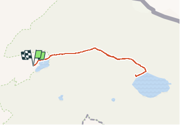

Length
7.6 km

Max alt
2458 m

Uphill gradient
188 m
Km-Effort
10.1 km

Min alt
2286 m

Downhill gradient
189 m
Boucle
Yes
Creation date :
2020-10-18 11:10:10.721
Updated on :
2020-10-18 14:03:07.457
2h44
Difficulty : Very easy

FREE GPS app for hiking
 SityTrail
IGN / Geographical institutes
SityTrail Plus
The world is yours!
About
Trail Walking of 7.6 km to be discovered at Auvergne-Rhône-Alpes, Savoy, Tignes. This trail is proposed by jpgo73.
Photos


Positioning
Country:
France
Region :
Auvergne-Rhône-Alpes
Department/Province :
Savoy
Municipality :
Tignes
Location:
Unknown
Start:(Dec)
Start:(UTM)
341226 ; 5039042 (32T) N.
Comments