


col vert

brandy
User
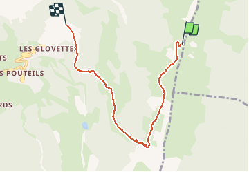

Length
6.6 km

Max alt
1743 m

Uphill gradient
158 m
Km-Effort
10.4 km

Min alt
1236 m

Downhill gradient
660 m
Boucle
No
Creation date :
2020-10-18 12:44:20.523
Updated on :
2020-10-18 15:35:23.752
2h50
Difficulty : Very easy

FREE GPS app for hiking
 SityTrail
IGN / Geographical institutes
SityTrail Plus
The world is yours!
About
Trail Walking of 6.6 km to be discovered at Auvergne-Rhône-Alpes, Isère, Villard-de-Lans. This trail is proposed by brandy.
Description
Très dur
Positioning
Country:
France
Region :
Auvergne-Rhône-Alpes
Department/Province :
Isère
Municipality :
Villard-de-Lans
Location:
Unknown
Start:(Dec)
Start:(UTM)
704481 ; 4992072 (31T) N.
Comments