


roche sadoule

Dupuybadonniere
User

Length
16.7 km

Max alt
612 m

Uphill gradient
505 m
Km-Effort
24 km

Min alt
233 m

Downhill gradient
562 m
Boucle
Yes
Creation date :
2020-10-18 07:57:20.416
Updated on :
2020-10-18 16:46:34.999
6h04
Difficulty : Very easy

FREE GPS app for hiking
 SityTrail
IGN / Geographical institutes
SityTrail Plus
The world is yours!
About
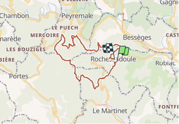
Trail Walking of 16.7 km to be discovered at Occitania, Gard, Robiac-Rochessadoule. This trail is proposed by Dupuybadonniere.
Positioning
Country:
France
Region :
Occitania
Department/Province :
Gard
Municipality :
Robiac-Rochessadoule
Location:
Unknown
Start:(Dec)
Start:(UTM)
586932 ; 4903280 (31T) N.
Comments