


col vert combe charbonniere boucle

brandy
User
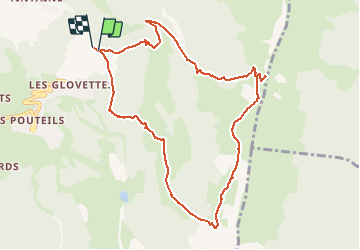

Length
10.6 km

Max alt
1746 m

Uphill gradient
703 m
Km-Effort
20 km

Min alt
1231 m

Downhill gradient
709 m
Boucle
Yes
Creation date :
2020-10-18 18:30:57.055
Updated on :
2020-10-18 19:17:06.087
3h58
Difficulty : Difficult

FREE GPS app for hiking
 SityTrail
IGN / Geographical institutes
SityTrail Plus
The world is yours!
About
Trail Walking of 10.6 km to be discovered at Auvergne-Rhône-Alpes, Isère, Villard-de-Lans. This trail is proposed by brandy.
Description
montée raide, descente de la combe charbonnière raide.
Positioning
Country:
France
Region :
Auvergne-Rhône-Alpes
Department/Province :
Isère
Municipality :
Villard-de-Lans
Location:
Unknown
Start:(Dec)
Start:(UTM)
702208 ; 4992373 (31T) N.
Comments