


Saint Marsal le col Palomère

jeanic63
User
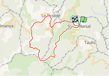

Length
18.3 km

Max alt
1425 m

Uphill gradient
975 m
Km-Effort
31 km

Min alt
622 m

Downhill gradient
975 m
Boucle
Yes
Creation date :
2020-10-18 20:28:24.302
Updated on :
2020-10-18 20:42:10.576
--
Difficulty : Difficult

FREE GPS app for hiking
 SityTrail
IGN / Geographical institutes
SityTrail Plus
The world is yours!
About
Trail On foot of 18.3 km to be discovered at Occitania, Pyrénées-Orientales, Saint-Marsal. This trail is proposed by jeanic63.
Description
départ parking de l'église de saint Marsal
Positioning
Country:
France
Region :
Occitania
Department/Province :
Pyrénées-Orientales
Municipality :
Saint-Marsal
Location:
Unknown
Start:(Dec)
Start:(UTM)
468826 ; 4709533 (31T) N.
Comments