


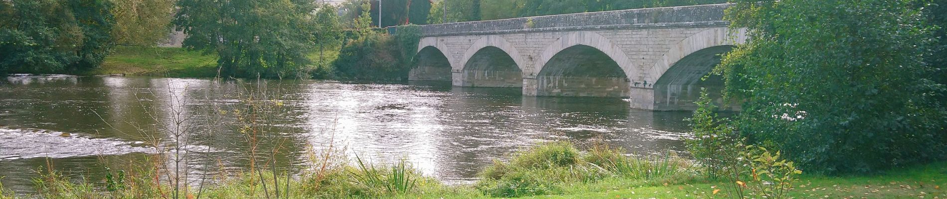
Le Moulin Parraud

Gegetop
User
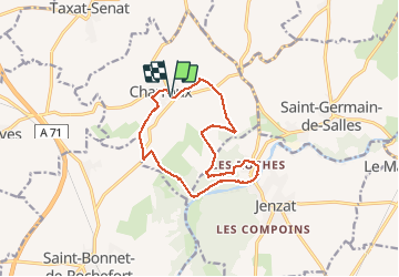

Length
13 km

Max alt
422 m

Uphill gradient
266 m
Km-Effort
16.5 km

Min alt
278 m

Downhill gradient
266 m
Boucle
Yes
Creation date :
2020-10-19 09:51:06.392
Updated on :
2020-10-19 13:37:03.502
3h30
Difficulty : Easy
3h07
Difficulty : Easy

FREE GPS app for hiking
 SityTrail
IGN / Geographical institutes
SityTrail Plus
The world is yours!
About
Trail Walking of 13 km to be discovered at Auvergne-Rhône-Alpes, Allier, Charroux. This trail is proposed by Gegetop.
Description
PR. 12
Balade agréable à travers tantôt la Limagne tantôt la forêt de chênes tantôt les Rives de la Sioule.
Photos

Positioning
Country:
France
Region :
Auvergne-Rhône-Alpes
Department/Province :
Allier
Municipality :
Charroux
Location:
Unknown
Start:(Dec)
Start:(UTM)
512637 ; 5114444 (31T) N.
Comments