


mt st michel

papou73
User
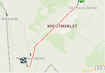

Length
960 m

Max alt
879 m

Uphill gradient
54 m
Km-Effort
1.6 km

Min alt
815 m

Downhill gradient
19 m
Boucle
No
Creation date :
2020-10-19 11:50:06.88
Updated on :
2020-10-19 14:46:52.907
3m
Difficulty : Very easy

FREE GPS app for hiking
 SityTrail
IGN / Geographical institutes
SityTrail Plus
The world is yours!
About
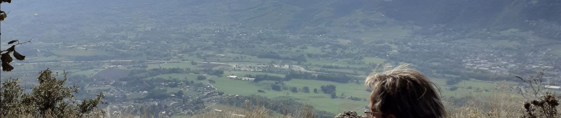
Trail Walking of 960 m to be discovered at Auvergne-Rhône-Alpes, Savoy, Curienne. This trail is proposed by papou73.
Photos


Positioning
Country:
France
Region :
Auvergne-Rhône-Alpes
Department/Province :
Savoy
Municipality :
Curienne
Location:
Unknown
Start:(Dec)
Start:(UTM)
266553 ; 5049173 (32T) N.
Comments