


Vachères 04

janussity
User

Length
17.8 km

Max alt
869 m

Uphill gradient
514 m
Km-Effort
25 km

Min alt
470 m

Downhill gradient
515 m
Boucle
Yes
Creation date :
2020-10-19 07:42:06.786
Updated on :
2020-10-19 14:53:57.124
4h47
Difficulty : Difficult

FREE GPS app for hiking
 SityTrail
IGN / Geographical institutes
SityTrail Plus
The world is yours!
About
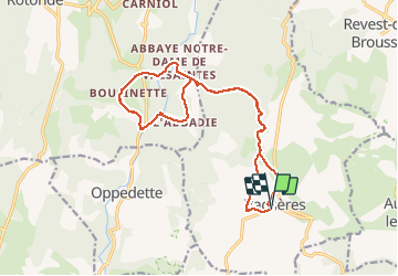
Trail Walking of 17.8 km to be discovered at Provence-Alpes-Côte d'Azur, Alpes-de-Haute-Provence, Vachères. This trail is proposed by janussity.
Description
grande virée sur des crêtes et des fonds de gorge. Passage à côté d'une abbaye et au saut du moine.
Photos


Positioning
Country:
France
Region :
Provence-Alpes-Côte d'Azur
Department/Province :
Alpes-de-Haute-Provence
Municipality :
Vachères
Location:
Unknown
Start:(Dec)
Start:(UTM)
711646 ; 4867639 (31T) N.
Comments