


St Etienne de Serre 15km

thonyc
User GUIDE
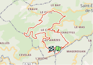

Length
15 km

Max alt
964 m

Uphill gradient
669 m
Km-Effort
24 km

Min alt
376 m

Downhill gradient
668 m
Boucle
Yes
Creation date :
2020-10-25 07:55:03.048
Updated on :
2020-10-26 08:34:16.083
5h33
Difficulty : Medium

FREE GPS app for hiking
 SityTrail
IGN / Geographical institutes
SityTrail Plus
The world is yours!
About
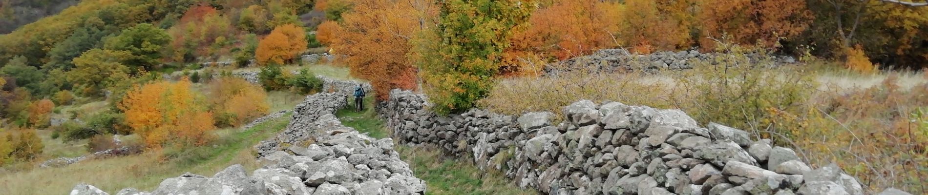
Trail Walking of 15 km to be discovered at Auvergne-Rhône-Alpes, Ardèche, Saint-Étienne-de-Serre. This trail is proposed by thonyc.
Photos


Positioning
Country:
France
Region :
Auvergne-Rhône-Alpes
Department/Province :
Ardèche
Municipality :
Saint-Étienne-de-Serre
Location:
Unknown
Start:(Dec)
Start:(UTM)
619816 ; 4959604 (31T) N.
Comments