Trail Walking Embrun - torrent sainte Marthe  - Photo
 guariso
guariso

User

© OpenStreetMap contributors
Length
Length
15.5 km
Max alt
Max alt
1667 m
Uphill gradient
Uphill gradient
834 m
Km-Effort
Km-Effort  
27 km
Min alt
Min alt
827 m
Downhill gradient
Downhill gradient
832 m
Boucle
Boucle
Yes
Creation date :
2020-10-28 08:35:50.968
Updated on :
2020-10-28 15:01:47.029

(0 Reviews)

Walking
Walking
5h34
Difficulty : Difficult

Scan this QR Code to open this trail in the SityTrail application

FREE GPS app for hiking

Logo SityTrail SityTrail

IGN / Geographical institutes

Download SityTrail from the App Store Download SityTrail from Google Play

Logo SityTrail SityTrail Plus

The world is yours!

Download SityTrail from the App Store Download SityTrail from Google Play Download SityTrail on Huawei AppGallery

About

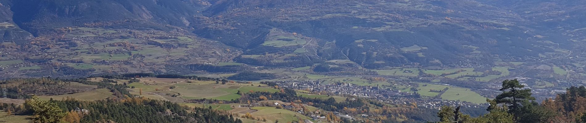
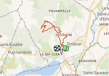
Trail Walking of 15.5 km to be discovered at Provence-Alpes-Côte d'Azur, Hautes-Alpes, Embrun. This trail is proposed by guariso.

Description

départ Embrun mais il est possible de raccourcir en montant un peu en voiture car le bas de la descente est sur route.
La montée initiale est un peu raide mais le suivi du torrent tout le long de la montée est très beau.

Elevation profile

Photos

Positioning

Country:
France
Region :
Provence-Alpes-Côte d'Azur
Department/Province :
Hautes-Alpes
Municipality :
Embrun
Location:
Unknown
Start:(UTM)
299934 ; 4936630 (32T) N.


Close
My subscriptions