


Hockai - La source de la Hoegne

AnneCecile
User
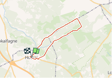

Length
10.9 km

Max alt
618 m

Uphill gradient
145 m
Km-Effort
12.8 km

Min alt
512 m

Downhill gradient
145 m
Boucle
Yes
Creation date :
2020-10-30 22:38:50.973
Updated on :
2020-10-30 22:46:32.215
--
Difficulty : Very easy

FREE GPS app for hiking
 SityTrail
IGN / Geographical institutes
SityTrail Plus
The world is yours!
About
Trail On foot of 10.9 km to be discovered at Wallonia, Liège, Stavelot. This trail is proposed by AnneCecile.
Positioning
Country:
Belgium
Region :
Wallonia
Department/Province :
Liège
Municipality :
Stavelot
Location:
Francorchamps
Start:(Dec)
Start:(UTM)
711905 ; 5596462 (31U) N.
Comments