


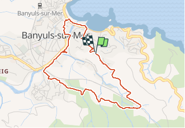
Rando Seris Banyuls et retour

BernardPONS
User

Length
4.9 km

Max alt
75 m

Uphill gradient
93 m
Km-Effort
6.2 km

Min alt
2 m

Downhill gradient
98 m
Boucle
Yes
Creation date :
2020-10-31 09:52:24.314
Updated on :
2020-10-31 14:31:29.133
1h16
Difficulty : Very easy

FREE GPS app for hiking
 SityTrail
IGN / Geographical institutes
SityTrail Plus
The world is yours!
About
Trail Walking of 4.9 km to be discovered at Occitania, Pyrénées-Orientales, Banyuls-sur-Mer. This trail is proposed by BernardPONS.
Positioning
Country:
France
Region :
Occitania
Department/Province :
Pyrénées-Orientales
Municipality :
Banyuls-sur-Mer
Location:
Unknown
Start:(Dec)
Start:(UTM)
511041 ; 4702758 (31T) N.
Comments