


Les Avins - vallée du Hoyoux

Michel1963
User GUIDE
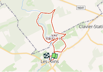

Length
7.8 km

Max alt
249 m

Uphill gradient
134 m
Km-Effort
9.6 km

Min alt
199 m

Downhill gradient
135 m
Boucle
Yes
Creation date :
2020-11-02 13:25:03.508
Updated on :
2020-11-02 15:14:59.869
1h48
Difficulty : Easy

FREE GPS app for hiking
 SityTrail
IGN / Geographical institutes
SityTrail Plus
The world is yours!
About
Trail Walking of 7.8 km to be discovered at Wallonia, Liège, Clavier. This trail is proposed by Michel1963.
Description
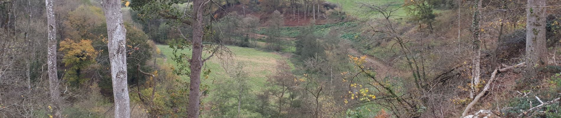
Balade extraordinaire...
Photos

Positioning
Country:
Belgium
Region :
Wallonia
Department/Province :
Liège
Municipality :
Clavier
Location:
Les Avins
Start:(Dec)
Start:(UTM)
663394 ; 5587317 (31U) N.
Comments