


20140323

fredodlageo
User
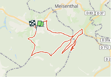

Length
10.8 km

Max alt
413 m

Uphill gradient
321 m
Km-Effort
15.2 km

Min alt
275 m

Downhill gradient
334 m
Boucle
Yes
Creation date :
2014-12-10 00:00:00.0
Updated on :
2014-12-10 00:00:00.0
2h24
Difficulty : Medium

FREE GPS app for hiking
 SityTrail
IGN / Geographical institutes
SityTrail Plus
The world is yours!
About
Trail Walking of 10.8 km to be discovered at Grand Est, Moselle, Soucht. This trail is proposed by fredodlageo.
Description
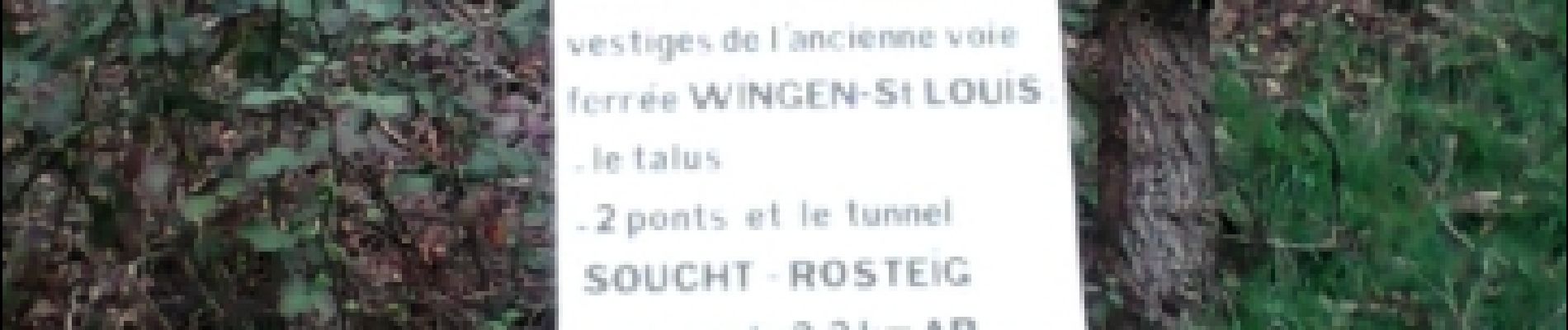
tunnel sourcht
Photos


Positioning
Country:
France
Region :
Grand Est
Department/Province :
Moselle
Municipality :
Soucht
Location:
Unknown
Start:(Dec)
Start:(UTM)
378094 ; 5423998 (32U) N.
Comments