


Tête de Rigaud

PEBREJOSIANE
User
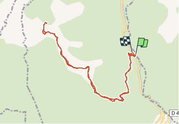

Length
13.5 km

Max alt
1873 m

Uphill gradient
1211 m
Km-Effort
30 km

Min alt
842 m

Downhill gradient
1174 m
Boucle
Yes
Creation date :
2014-12-10 00:00:00.0
Updated on :
2014-12-10 00:00:00.0
6h00
Difficulty : Medium

FREE GPS app for hiking
 SityTrail
IGN / Geographical institutes
SityTrail Plus
The world is yours!
About
Trail Walking of 13.5 km to be discovered at Provence-Alpes-Côte d'Azur, Maritime Alps, Pierlas. This trail is proposed by PEBREJOSIANE.
Description
Rando dont le départ se fait sur la route du Cians balise 211 et qui se déroule en totalité dans les pélites rouges.
Superbe point de vue de la tête de Rigaud sur le Mercantour
Positioning
Country:
France
Region :
Provence-Alpes-Côte d'Azur
Department/Province :
Maritime Alps
Municipality :
Pierlas
Location:
Unknown
Start:(Dec)
Start:(UTM)
338131 ; 4876180 (32T) N.
Comments