


aywaille . florzé . martinrive . septroux . aywaille

stef789
User GUIDE
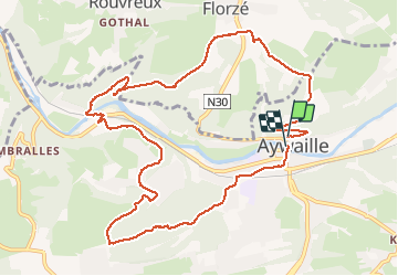

Length
11.1 km

Max alt
277 m

Uphill gradient
317 m
Km-Effort
15.4 km

Min alt
112 m

Downhill gradient
344 m
Boucle
Yes
Creation date :
2020-11-10 08:40:35.219
Updated on :
2020-11-10 11:29:35.21
2h48
Difficulty : Easy

FREE GPS app for hiking
 SityTrail
IGN / Geographical institutes
SityTrail Plus
The world is yours!
About
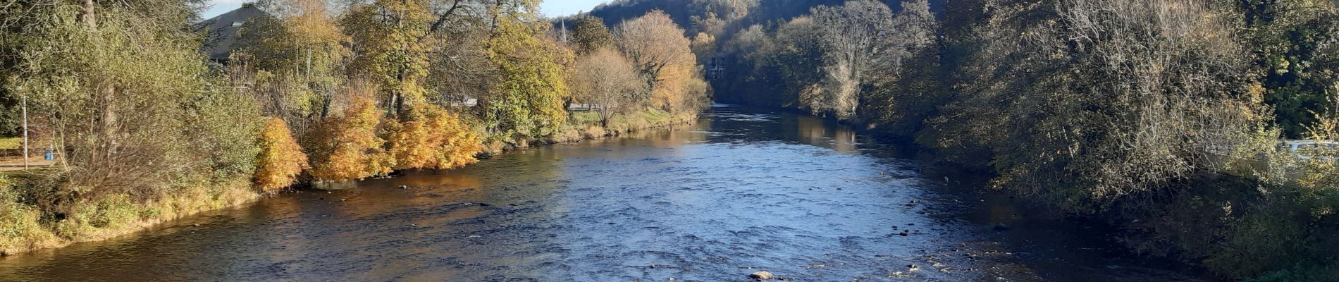
Trail Walking of 11.1 km to be discovered at Wallonia, Liège, Aywaille. This trail is proposed by stef789.
Photos


Positioning
Country:
Belgium
Region :
Wallonia
Department/Province :
Liège
Municipality :
Aywaille
Location:
Aywaille
Start:(Dec)
Start:(UTM)
689828 ; 5595071 (31U) N.
Comments
superbe balade aux paysages différents. au niveau du chemin de fer ne descendez pas comme indiqué à gauche car impraticable mais continuez jusqu'à la maison après le pont et passez par l arrière pour rejoindre la route.
Très belle découverte. Merci !
24.03.21 - Très divers, bois - ruines - campagne - Belles vues sur la vallée