


Stavelot

AnneCecile
User
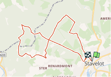

Length
11.1 km

Max alt
510 m

Uphill gradient
312 m
Km-Effort
15.2 km

Min alt
298 m

Downhill gradient
312 m
Boucle
Yes
Creation date :
2020-11-20 20:54:18.814
Updated on :
2020-11-20 21:08:49.714
--
Difficulty : Very easy

FREE GPS app for hiking
 SityTrail
IGN / Geographical institutes
SityTrail Plus
The world is yours!
About
Trail On foot of 11.1 km to be discovered at Wallonia, Liège, Stavelot. This trail is proposed by AnneCecile.
Positioning
Country:
Belgium
Region :
Wallonia
Department/Province :
Liège
Municipality :
Stavelot
Location:
Stavelot
Start:(Dec)
Start:(UTM)
708222 ; 5586628 (31U) N.
Comments