


J1

CABERMAT
User
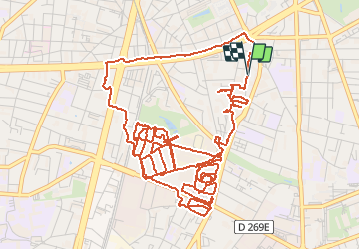

Length
10.7 km

Max alt
236 m

Uphill gradient
75 m
Km-Effort
11.7 km

Min alt
209 m

Downhill gradient
79 m
Boucle
Yes
Creation date :
2020-11-22 12:57:00.335
Updated on :
2020-11-22 15:15:30.99
1h52
Difficulty : Very easy

FREE GPS app for hiking
 SityTrail
IGN / Geographical institutes
SityTrail Plus
The world is yours!
About
Trail Walking of 10.7 km to be discovered at Auvergne-Rhône-Alpes, Isère, Grenoble. This trail is proposed by CABERMAT.
Positioning
Country:
France
Region :
Auvergne-Rhône-Alpes
Department/Province :
Isère
Municipality :
Grenoble
Location:
Unknown
Start:(Dec)
Start:(UTM)
714286 ; 5006524 (31T) N.
Comments