


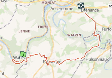
De Waulsort à Dréhance

dodobernier
User

Length
14.3 km

Max alt
258 m

Uphill gradient
394 m
Km-Effort
19.1 km

Min alt
92 m

Downhill gradient
255 m
Boucle
No
Creation date :
2020-11-23 06:45:10.144
Updated on :
2023-07-23 08:08:42.671
4h20
Difficulty : Very difficult
--
Difficulty : Easy

FREE GPS app for hiking
 SityTrail
IGN / Geographical institutes
SityTrail Plus
The world is yours!
About
Trail Walking of 14.3 km to be discovered at Wallonia, Namur, Hastière. This trail is proposed by dodobernier.
Positioning
Country:
Belgium
Region :
Wallonia
Department/Province :
Namur
Municipality :
Hastière
Location:
Unknown
Start:(Dec)
Start:(UTM)
632754 ; 5562593 (31U) N.
Comments