Trail Walking Revel - Mongiron - Photo
 flip38
flip38

User

© OpenStreetMap contributors
Length
Length
9.4 km
Max alt
Max alt
967 m
Uphill gradient
Uphill gradient
459 m
Km-Effort
Km-Effort  
15.5 km
Min alt
Min alt
610 m
Downhill gradient
Downhill gradient
456 m
Boucle
Boucle
Yes
Creation date :
2020-11-28 11:53:44.45
Updated on :
2020-12-22 21:57:12.101

(0 Reviews)

Walking
Walking
2h24
Difficulty : Easy

Scan this QR Code to open this trail in the SityTrail application

FREE GPS app for hiking

Logo SityTrail SityTrail

IGN / Geographical institutes

Download SityTrail from the App Store Download SityTrail from Google Play

Logo SityTrail SityTrail Plus

The world is yours!

Download SityTrail from the App Store Download SityTrail from Google Play Download SityTrail on Huawei AppGallery

About

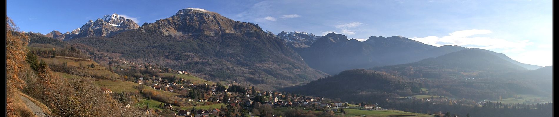
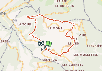
Trail Walking of 9.4 km to be discovered at Auvergne-Rhône-Alpes, Isère, Revel. This trail is proposed by flip38.

Description

Belle randonnée au départ du village de Revel qui permet de profiter de beaux panoramas sur les massifs environnants et la vallée grenobloise.
Sentiers ou chemins évidents même si une partie n'est pas balisée (toute la ligne de crête de Mongiron).

Elevation profile

Photos

Positioning

Country:
France
Region :
Auvergne-Rhône-Alpes
Department/Province :
Isère
Municipality :
Revel
Location:
Unknown
Start:(UTM)
725301 ; 5007553 (31T) N.


Close
My subscriptions