


2020-12-04 Rando Fontaineliveau

jchezlemas
User
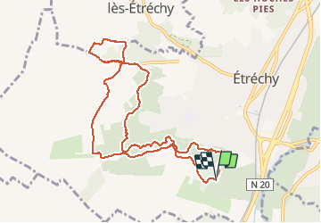

Length
10.6 km

Max alt
156 m

Uphill gradient
198 m
Km-Effort
13.2 km

Min alt
98 m

Downhill gradient
197 m
Boucle
Yes
Creation date :
2020-12-04 13:17:41.175
Updated on :
2020-12-05 09:34:25.515
2h51
Difficulty : Easy

FREE GPS app for hiking
 SityTrail
IGN / Geographical institutes
SityTrail Plus
The world is yours!
About
Trail Walking of 10.6 km to be discovered at Ile-de-France, Essonne, Étréchy. This trail is proposed by jchezlemas.
Positioning
Country:
France
Region :
Ile-de-France
Department/Province :
Essonne
Municipality :
Étréchy
Location:
Unknown
Start:(Dec)
Start:(UTM)
439641 ; 5369982 (31U) N.
Comments