


Monteneau - La Rivière d'or

AnneCecile
User
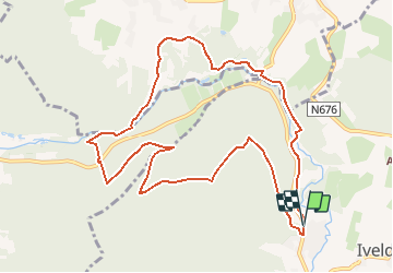

Length
10.3 km

Max alt
570 m

Uphill gradient
306 m
Km-Effort
14.4 km

Min alt
386 m

Downhill gradient
307 m
Boucle
Yes
Creation date :
2020-12-05 09:33:42.285
Updated on :
2020-12-05 09:57:49.638
--
Difficulty : Very easy

FREE GPS app for hiking
 SityTrail
IGN / Geographical institutes
SityTrail Plus
The world is yours!
About
Trail On foot of 10.3 km to be discovered at Wallonia, Liège, Amel. This trail is proposed by AnneCecile.
Description
Départ Eglise de Montenau
Parking à proximité du centre de séminaire St Raphael (Klosterstrasse 66, 4770 Amel)
Positioning
Country:
Belgium
Region :
Wallonia
Department/Province :
Liège
Municipality :
Amel
Location:
Amel
Start:(Dec)
Start:(UTM)
295194 ; 5583179 (32U) N.
Comments