


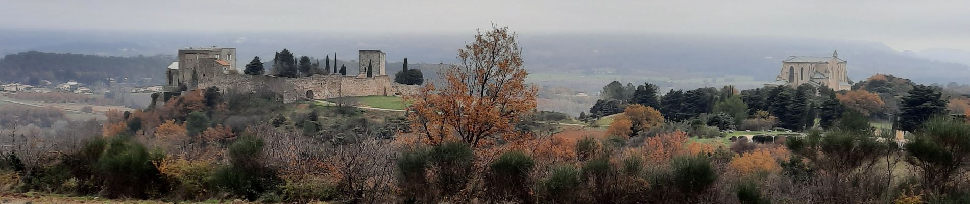
Roussas 8km

thonyc
User GUIDE
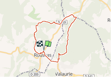

Length
7.9 km

Max alt
219 m

Uphill gradient
213 m
Km-Effort
10.8 km

Min alt
111 m

Downhill gradient
214 m
Boucle
Yes
Creation date :
2020-12-06 12:26:44.508
Updated on :
2020-12-06 19:21:19.866
2h32
Difficulty : Easy

FREE GPS app for hiking
 SityTrail
IGN / Geographical institutes
SityTrail Plus
The world is yours!
About
Trail Walking of 7.9 km to be discovered at Auvergne-Rhône-Alpes, Drôme, Roussas. This trail is proposed by thonyc.
Photos


Positioning
Country:
France
Region :
Auvergne-Rhône-Alpes
Department/Province :
Drôme
Municipality :
Roussas
Location:
Unknown
Start:(Dec)
Start:(UTM)
643485 ; 4921424 (31T) N.
Comments